Skip to content

Stream Continuity and Infrastructure Assessment Project Update

No Close
1. Massachusetts Environmental Trust Grants (FY2016) includes partner project in Boxford
2. Stream Continuity and Infrastructure Assessment Project Update
3. Great Marsh Awarded Federal Wetlands Grant
4. Marsh Adaptation Strategy Tool (MAST)
5. King Tides and Sea Level Rise
6. MyCoast Tracks Coastal Storms
7. PIE Rivers Annual Meeting Promotes the Power of Partnerships
8. New Flooding and Sea Level Rise Maps Aid Resiliency Planning Efforts
9. Essex Tech Students Study Plum Island Beach Movement
10. COAST Analysis of Newburyport
11. Planning Partners Report Progress
12. Ipswich River Re-opens to Shellfishing
13. Partners remove over 600 tires during “Turtle Land” cleanup
14. Greenbelt One Step Closer to Protecting Leonhard-Eldred Farm
15. Native Plantings and Sand Fencing Help Beach Dune Restoration
16. Improved fish ladder proposed for Willowdale Dam
17. Dune Resiliency Efforts on Salisbury Beaches
18. EPA Releases Stormwater Permit
19. Greenbelt Steps Closer to Conserving Sagamore Hill
20. Ipswich High Students Explore Sea Level Rise
21. PIE-Rivers Partners Gather for Great Marsh Resiliency Modeling Workshop
22. Communities Plan for Living Shorelines
23. Local Students Give Presentations on Sea Level Rise and Storm Surge Impacts
24. Partner efforts help river herring upstream
25. Communities Take Action on Resiliency
26. Survey Work Begins at Ipswich Mills Dam
27. Town of Ipswich Receives Coastal Resiliency Grant
28. Ipswich Dam Team Visits Exeter Restoration Project
29. Nanotags: Understanding large landscape connections using nano-technology
30. Coastal Resiliency Planning Project Works on Solutions
31. PIE-Rivers Partnership Annual Meeting 2016
32. Great Marsh Sea Level Rise Symposium: Implications for Quality of Life in Our Communities
33. Greenbelt Hosts Inaugural Essex County Open Space Conference
34. Salt Marsh Science Project Celebrated 20th Anniversary
35. 2016 PIE-Rivers Annual Meeting
36. EPA Releases Dam Removal FAQ
37. Choate Island Forest Clearing Project
38. Partners Protect Castle Neck Headwaters
39. Wenham and Boxford receive DER assistance to upgrade degraded culverts
40. PIE-Rivers Partnership Annual Meeting 2017
41. PIE-Rivers Partners Celebrate 2017 Accomplishments
42. The Great Marsh Coastal Adaptation Plan Is Now Online

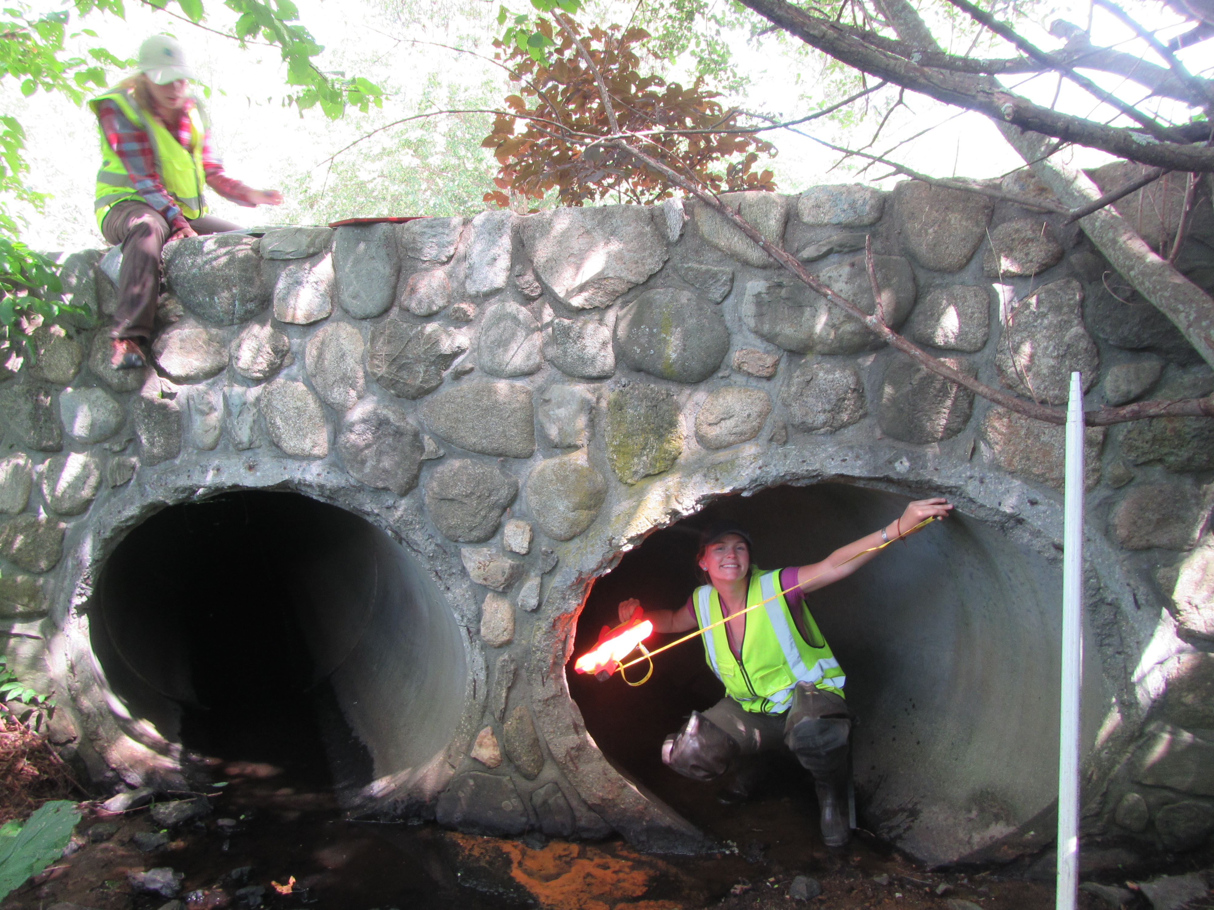
The summer of 2015 was marked by a big data collection push to help identify and prioritize problem in-stream barriers throughout the PIE-Rivers region. In June, field crews began the arduous task of collecting precise measurements including bridge dimensions and elevation data at all major road-stream crossings in the three watershed area (plus Salisbury). Our crews have already surveyed over 550 sites and will be wrapping up this effort in the next few weeks, just in time to have our partners at Trout Unlimited run the information through models to test how the structures might fair during large rain storms. Over the next few months we will be using the results of this and a number of other partner-led investigations to develop the most thorough analysis of barriers (including road-stream crossings, dams and seawalls) that the region has ever had at its disposal. We will be partnering with interested communities to use these results to plan for the future with an eye on both ecology and infrastructure vulnerability.

For more on this project

Comments (0)

Leave a Reply

Your email address will not be published. Required fields are marked *

Back To Top