Following the recent clearing at Alewife Brook to improve fish passage, many people have been…
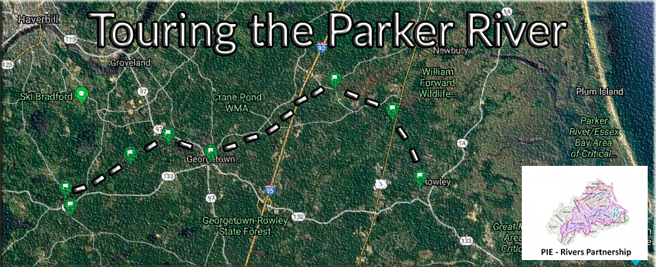
Touring the Parker
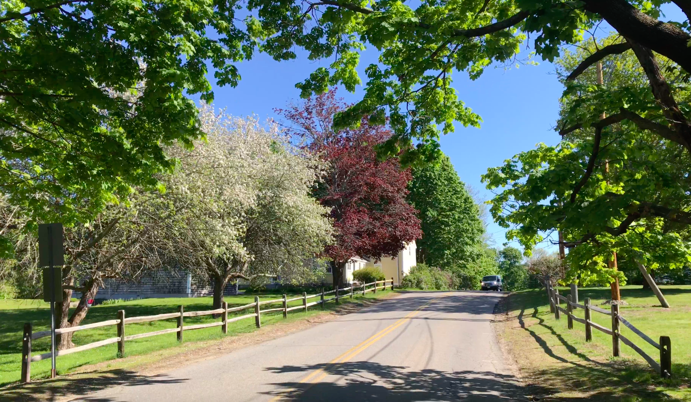
Drive twenty miles north of Boston and you will find a meandering river cutting its way through beautiful countryside on its way to Plum Island Sound, part of the much larger Gulf of Maine. Home to threatened turtles, vast wetlands, and around 80,000 people, the Parker is a treat for anyone who loves rivers and scenic New England villages. But it’s also a cautionary tale of what’s in store for our region as our climate and development patterns continue to change.
Today I’m touring the headwaters. We are about fifteen miles inland from Plum Island and the Great Marsh, site of the Parker River National Wildlife Refuge and a popular spot for both experienced birdwatchers and the recent explosion of urban birders.
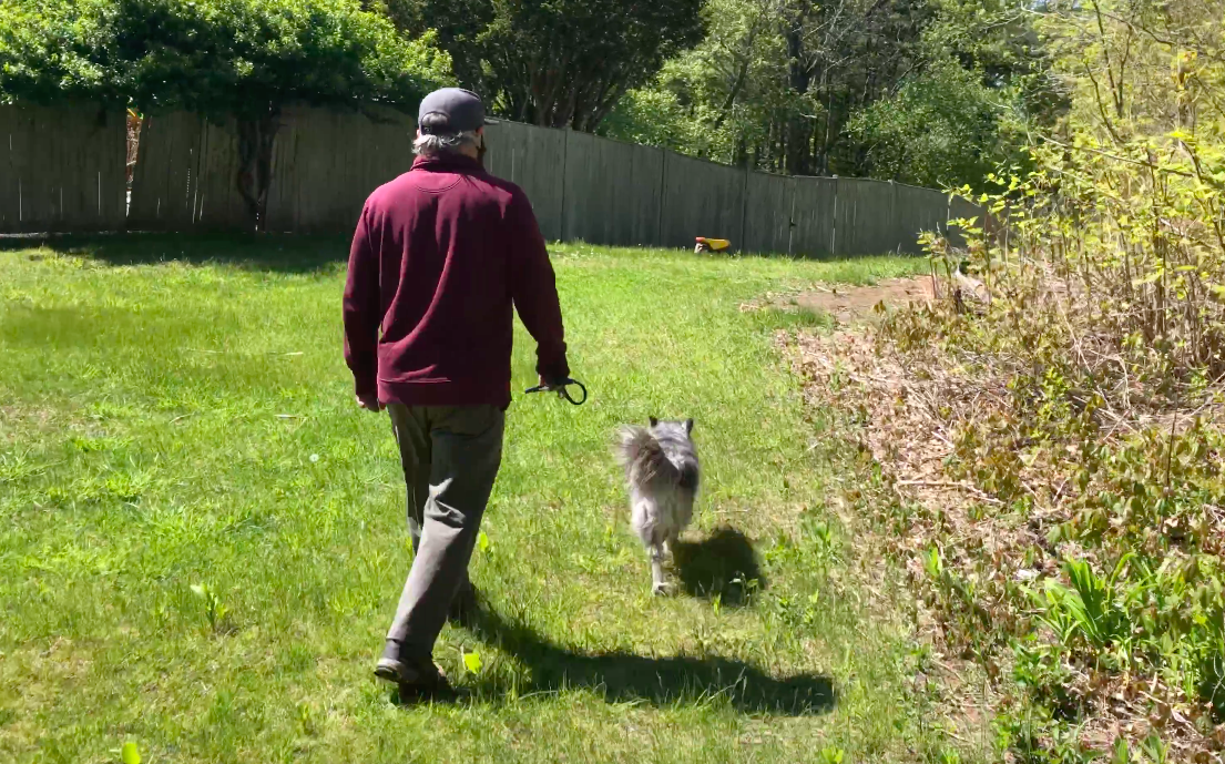
My guide on this warm spring day is George Comiskey, of the Parker River Clean Water Association, and his dog Río. Comiskey grew up in Peabody but has called Georgetown his home for decades. Together, he and his fellow river advocates have helped carry out water quality testing for nearly 25 years, ever since they formed back in 1994. To this day PRCWA remains the leading advocate for the river, well known to residents in each of the watershed’s nine towns.
Low-Impact Development
Before we go to the headwaters we meet at the Georgetown transit parking lot (socially distanced, in separate cars and using masks). The lot is located next to a marsh that drains into Penn Brook. As Comiskey tells me, the Town is planning Low-Impact Development (LID) for the lot to reduce storm runoff, following up on their Municipal Vulnerability Preparedness planning. Centrally located and used by both commuters and students at nearby Georgetown High, the site is a great spot for demonstrating the benefits of LID and helping Parker communities transition away from permeable surfaces (aka pavement).
When surfaces don’t drain, they create runoff that impacts water quality and prevents groundwater recharge. Impervious surfaces in concentrated areas like central Georgetown also contribute to ‘heat islands’ that impact public health as our climate warms. As the Merrimack Valley Planning Council highlighted during recent MVP Planning workshops in Rowley and North Andover, so-called ‘heat days’ are on the rise in our region. According to the Northeast Regional Climate Center, by the end of the century we will see an increase of up to 67 days where temperatures climb above 90 degrees Fahrenheit. Average annual temperature in the Parker River Basin is projected to rise by 3.7 to 10.9 degrees Fahrenheit.
Wells and More Wells
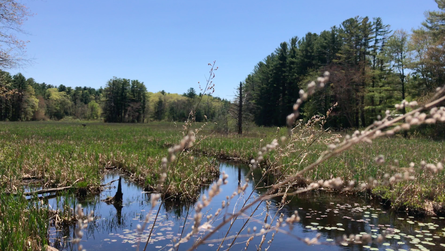
Our official tour starts at Sperry’s Pond in West Boxford; the headwaters of the Parker. The pond offers beautiful views. On a calm day it creates a mirror reflecting the sky and trees on the other side, which is mostly undeveloped.
Sperry’s Pond is also the beginning of a never-ending series of public and private wells. These wells act like a series of large drinking straws, draining the groundwater below and impacting flow levels. “If you asked me what the big issues are in the Parker, I would say low flow, and the other is dams,” says Comiskey. As I will learn on today’s tour, the lack of enough clean water is severe enough that towns like Rowley are making it a priority in their MVP planning.
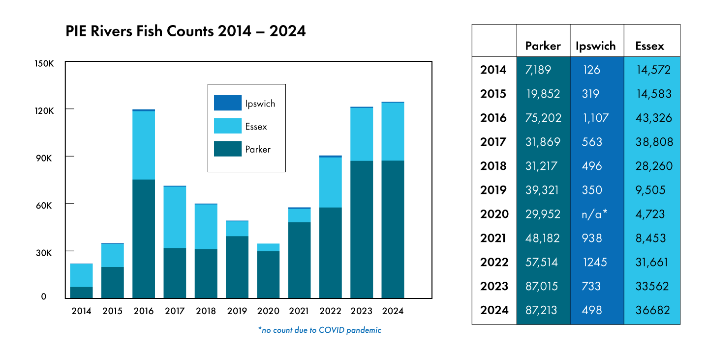
Along the way we stop to check out several culverts and fish ladders designed to improve stream connectivity and restore native fish runs. The Towns of the Parker, as well as advocacy groups like PRCWA and Trout Unlimited, are working to upgrade these man-made features and carry out fish counts to track progress. New box culverts, like the one we visit at the exit of the Georgetown wellfield, also help with flood management. “This was a high-flood area before they put this culvert in,” Comiskey says. “They actually raised the road.”
Other river systems in the Gulf of Maine— ranging from the Mystic to the Penobscot— are seeing huge increases in fish runs after removing barriers. The news may be less drastic in the Parker, but the Department of Marine Fisheries has noted at least one location—the Central Street fish ladder in Byfield—seeing an increase after repairing a culvert. You can check out the 2018 Great Marsh Barriers Assessment for more information and a ‘To-Do list,’ ranking every culvert and stream barrier in the PIE-Rivers Region, which has become a tool for towns looking to prioritize funds and collaborate to restore critical habitat.
Next up is a visit to Rock Pond, where PRCWA did their initial water quality monitoring right below the wellfield. As Comiskey explains, this site has some of the lowest dissolved oxygen levels in the region.
Once again, the issue comes back to low flow. Comiskey puts it bluntly. “If the wellfield is pumped dry, there’s no water. There’s no dissolved oxygen. That’s the biggest problem we have here.”
Turtle Power
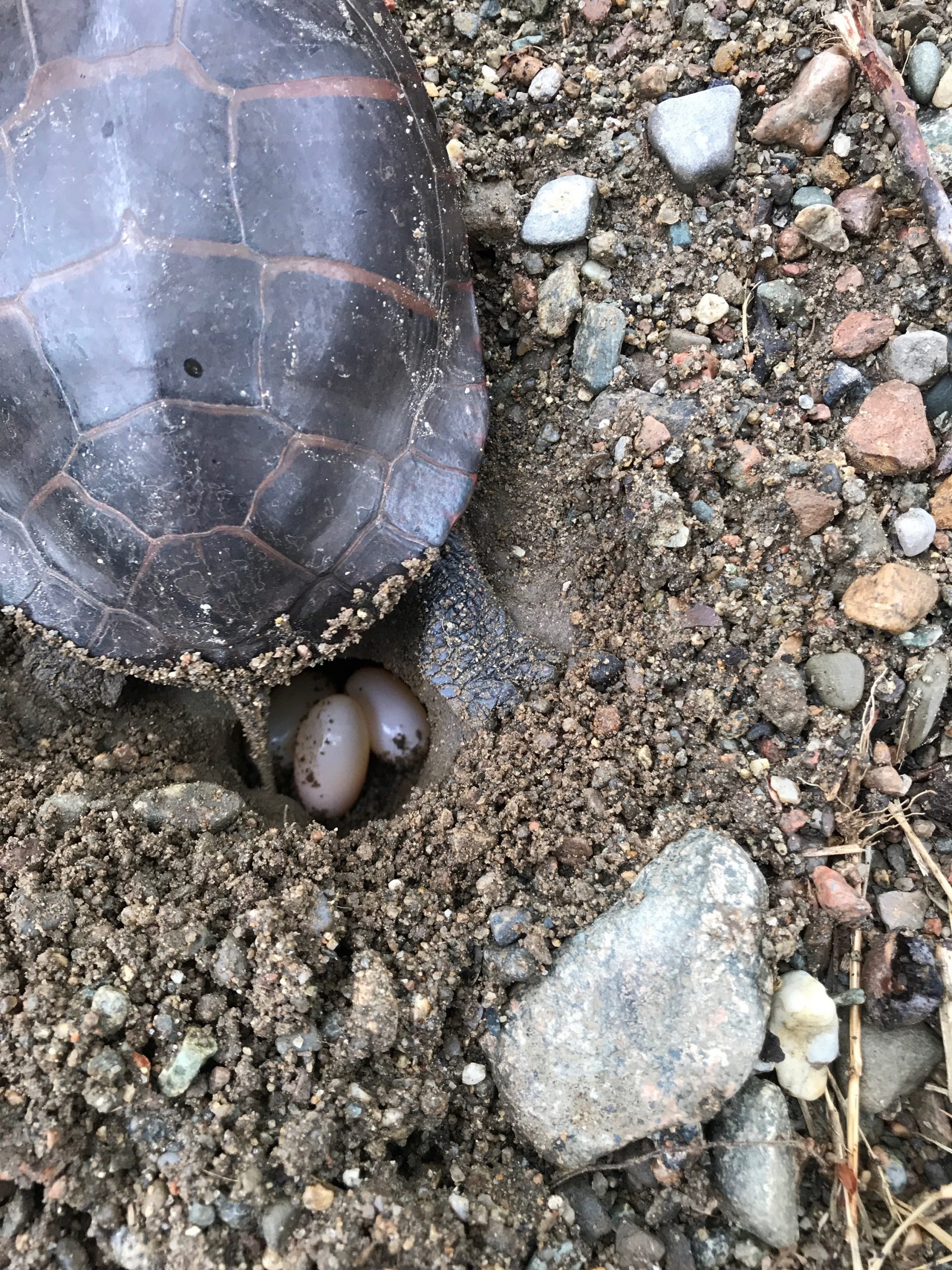
Comiskey also points out signage created to let people know about Blanding’s Turtles, a threatened species found in the northern US and parts of Canada. When culverts aren’t properly modified to let partial light through, the turtles are forced to cross over roads and into traffic.
Comiskey would like to see more efforts in the watershed to think about habitat when upgrading culverts. “All the way back to the last spot we visited, the river runs dry. And like I said, this is great turtle habitat.” Programs like ‘headstarting,’ where schools or individuals help raise juvenile turtles for a year before releasing them into the wild, are one way our towns can take action. But the much larger issue is taking a closer look at stream continuity, and how our infrastructure creates unintended barriers to wildlife.
Planning for a New Climate
Over the course of the tour a story has taken shape. The Parker River watershed, like the neighboring Ipswich and Essex watersheds, is severely impacted by water withdrawals. Well after well, both private and public, has tapped into the aquifer. This method of water extraction goes back to the days when water was still thought of as an infinite resource.
Now that we realize freshwater is limited and is no longer a guarantee, what solutions do the towns have to safeguard water levels for future generations?
As the climate changes and more development happens, we owe it to future generations to shift our towns to Net-Zero Water Use Policies sooner, rather than later. Towns like Ipswich have already begun. Most towns in our region have completed the first phase of MVP Planning and are moving into grants and projects to better prepare residents for a more resilient future. If you’d like to get involved in your town, please contact the PIE-Rivers Partnership Coordinator to learn more, or reach out directly to your town’s Conservation Office. If you’re a town staff or board member or resident involved in town planning, check out the suggestions for action items you can recommend in the Net-Zero Toolkit. Actionable items range from updating bylaws and ordinances mandating LID, to establishing water conservation incentive programs to pay for residential and commercial water audits, rain barrels, or other measures that help capture and utilize rainwater on-site and limit runoff. Taken together, each of these actions gets us one step closer to having enough clean water for our communities.
The Town of Rowley’s MVP Planning Process in particular, in which PRCWA’s members are involved, is one that matters a lot for the future of the Parker and addressing issues we saw during our tour. While the process is ongoing, some of the main vulnerabilities identified so far include drought impacts on river quality, groundwater protection, clear cutting for development, and the need to focus on green infrastructure.
Above all, greater collaboration by towns across all three watersheds— Parker, Ipswich, and Essex— is a must if we are going to plan better for the future. You can join in telling the story of our three watersheds today by adding to Our Shared Watershed Journal, created by Ann Witzig of PRCWA using lessons provided by Joseph Kerski.
Thank you to George, to the Parker River Clean Water Association, and of course to Río.
Related Posts
Comments (0)