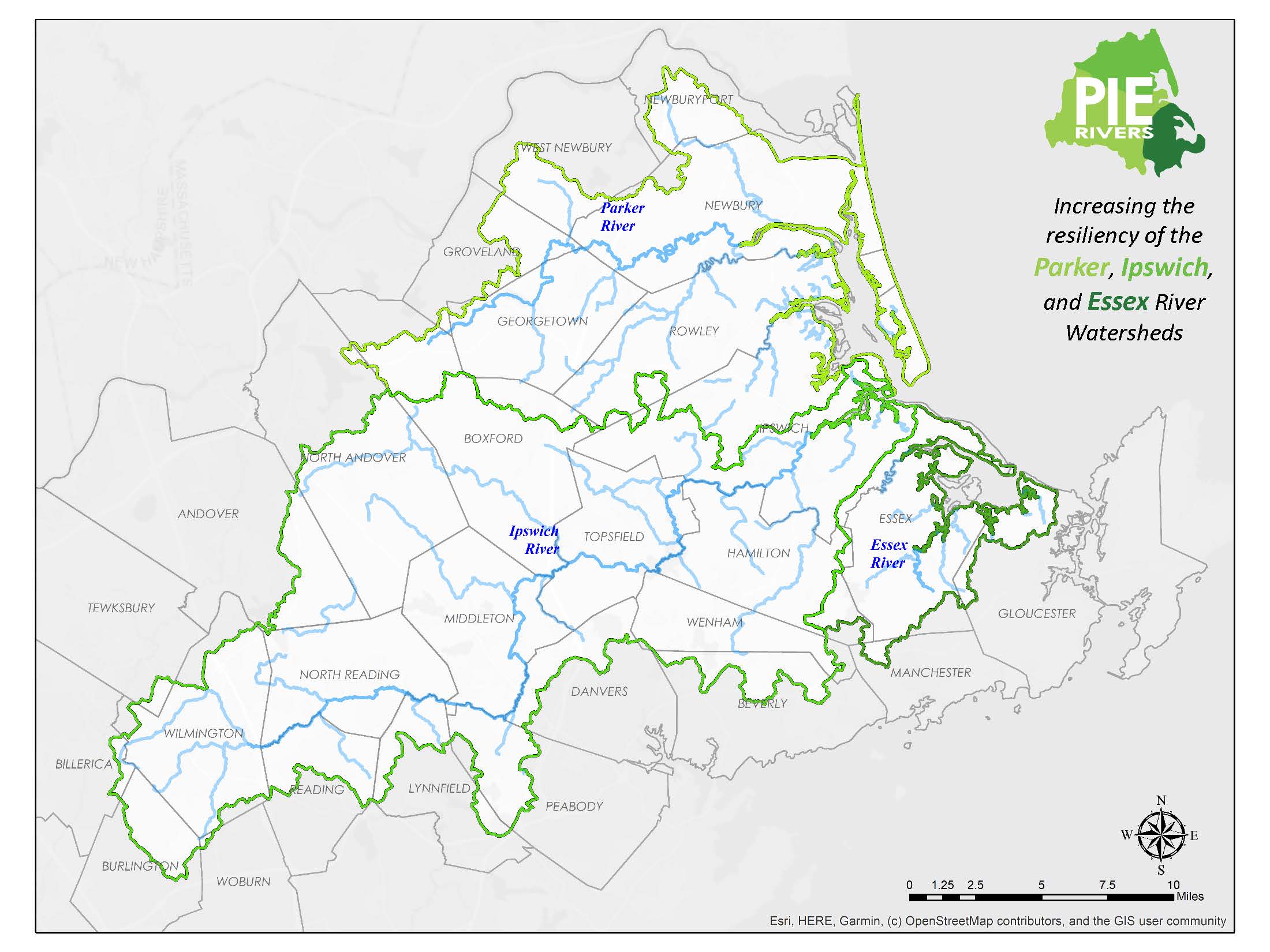
The PIE-Rivers region refers to the combined watersheds and estuaries of the Parker, Ipswich and Essex Rivers in northeastern Massachusetts. This area encompasses all or parts of 28 towns. The Parker, Ipswich and Essex River Watersheds and Great Marsh offer some of the most outstanding ecological resources in Massachusetts. The region includes large areas of permanently protected land, including a national wildlife refuge, several state parks and forests, and other publicly and privately held conservation lands. The watersheds include extensive state-designated high quality natural resources and several coldwater fisheries, which are rare in eastern Massachusetts.
The Parker and Ipswich river basins make up the watershed of Plum Island Sound, the largest wetland-dominated estuary in New England, supporting extremely productive commercial and recreational soft-shell clam and striped bass fisheries. Together with the Essex, these rivers encompass the entire coastal watershed between the Merrimack River and Cape Ann. The coastal zone of the watersheds comprises much of the Great Marsh, the largest continuous salt marsh in New England.
The estuaries of the Great Marsh and their contributing watersheds also host a multitude of recreational and commercial activities including boating, sailing, angling, shellfishing, swimming, birding, kayaking and canoeing. The Parker River National Wildlife Refuge is a major ecological resource as well as an internationally known birding area. The entire project area is part of the Essex National Heritage Area, designated by Congress as a nationally important landscape.
These river basins are also the subject of an outstanding body of scientific research by the Marine Biological Laboratory at Woods Hole, Plum Island Long Term Ecological Research Program (PIE-LTER), the University of New Hampshire, UMASS Amherst, the U.S. Geological Survey (USGS) and others.
Learn about some of the ecological threats facing the region that the Partnership is working to address.

